Gollapalli Fm
Type Locality and Naming
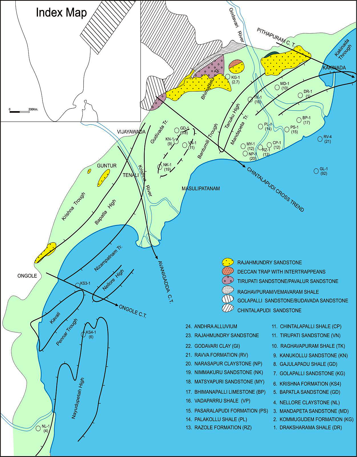
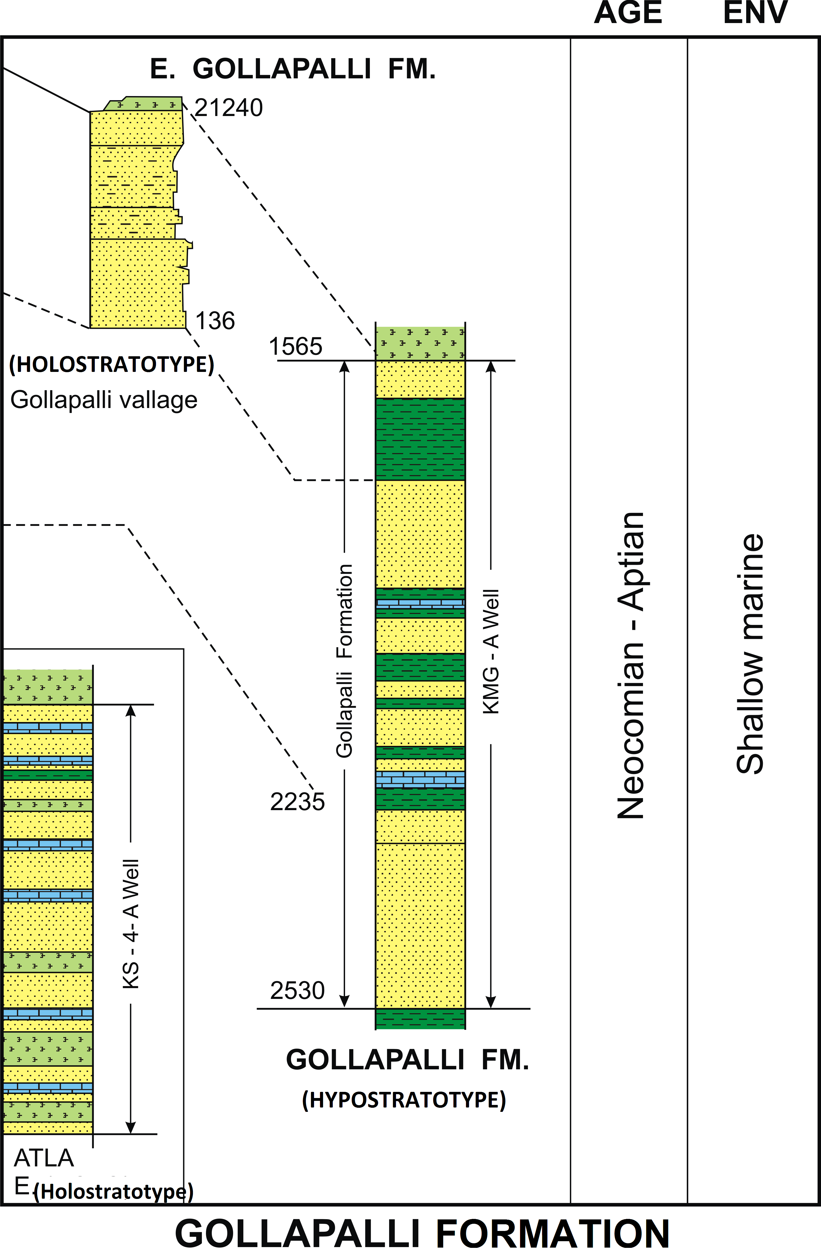
LANDWARD: Named after the Gollapalli Village, Andhra Pradesh. The type section is exposed near Gollapalli village about 15 km north of Eluru town. The hypostratotype is in the well Kommugudem-A (depth interval: 1565-2235m). It was named after the Gollapalli village by ONGC team steered by Venkatarengan et al. (1993) and issued as Document-VII by KDMIPE, ONGC, Dehradun (1993). [Original Publication: King, W. (1870) The Upper Gondwanas and other formations of the coastal region of the Godavari district. Memoir of Geological Survey of India, vol. 6, pt 3.pp.]. Reference well: Well Kommugudem-A, Interval 1565-2235 m and thickness 670 m.
Synonyms: Gollapalli Sandstone
[Figure: Map showing the locations of designated holostratotype section for the formation in the KG Basin (After ONGC, Pandey and Dave, 1998) in Raju et al., 2021, ONGC Bulletin, Special Issue, Vol. 56, No. 2]
Lithology and Thickness
Sandstone. The type section is characterized by hard, red brown, ferruginous, conglomeratic to coarse-grained sandstone at the base; brown ferruginous claystone, siliceous shale, shaly sandstone and purple sandstone in the middle; and white to pale white, compact sandstone with siltstone partings at the top. The reference section (Well Kommugudem-A) is characterized by light gray, moderately hard, poorly sorted, fine- to medium-grained, feldspathic sandstones and light to dark gray, compact micaceous shales with coal bands at places. Its thickness varies from 50-670 m.
[Figure: Lithology, age and environment of the Holostratotype in the outcrops at Gollapalli village and Well KS-4-A and hypostratotype section (Well KMG-A) of the Gollapalli Formation (after Venkatrengan et al., 1993; Bijai Prasad, 1999)]
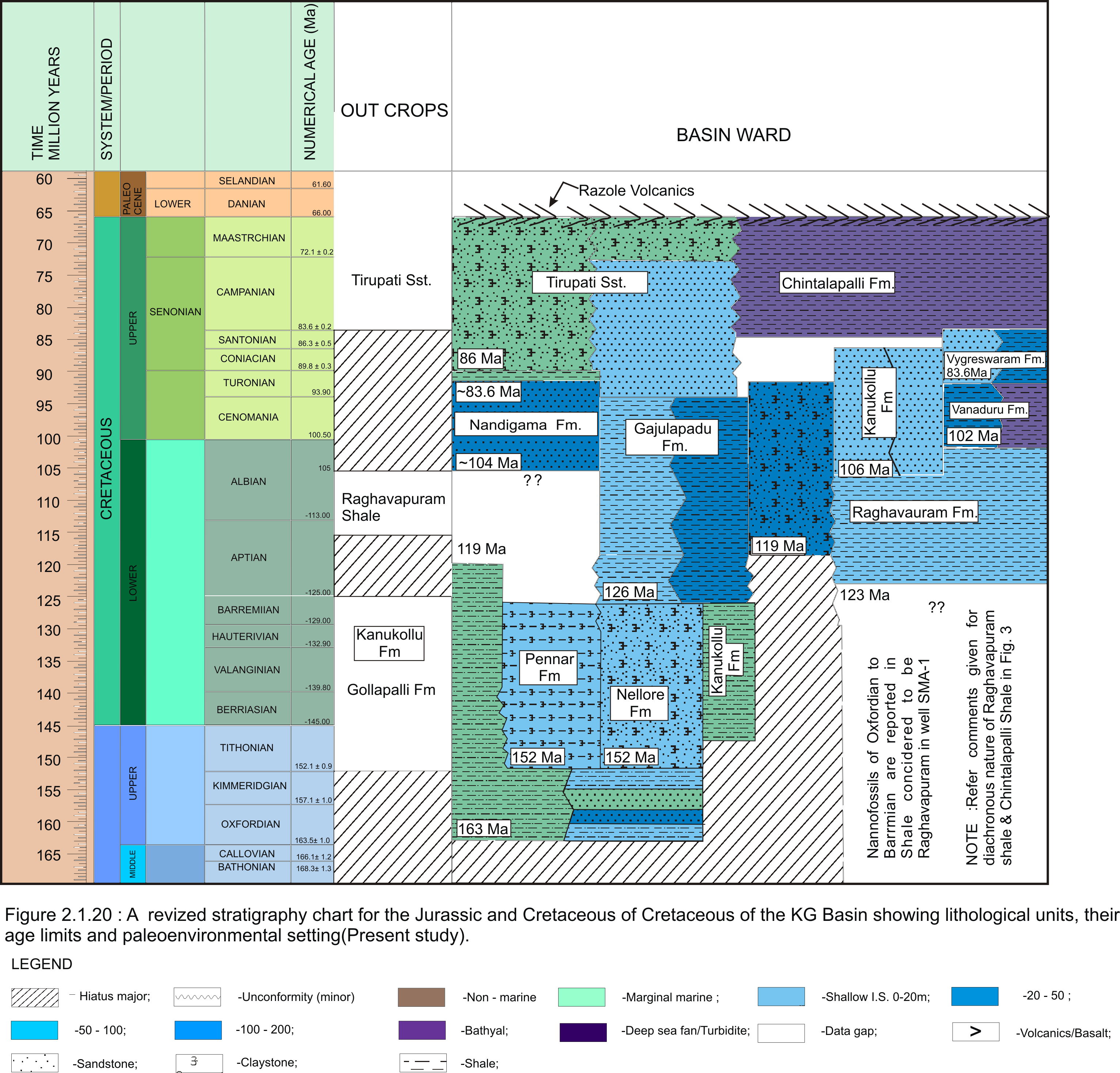
[Figure: A revised stratigraphy chart for the Jurassic and Cretaceous of the KG Basin showing lithological units, their age limits and paleoenvironmental setting (present study) in Raju et al., 2021, ONGC Bulletin, Special Issue, Vol. 56, No. 2]
Relationships and Distribution
Lower contact
Major Hiatus -- Unconformable with the Mandapeta Fm / Krishna Fm.
Upper contact
Conformable with the Raghavapuram Fm.
Regional extent
Extended in Pennar and Nizampatnam grabens.
GeoJSON
Fossils
Plant megafossils- Cladophlebis indicus, C. longipennis, Gleichenidites nordenskioldi, Sphenopteris speciosa and Onychiopsis psilotoides in the outcrop and dinoflagellate cysts in the well section.
Age
Depositional setting
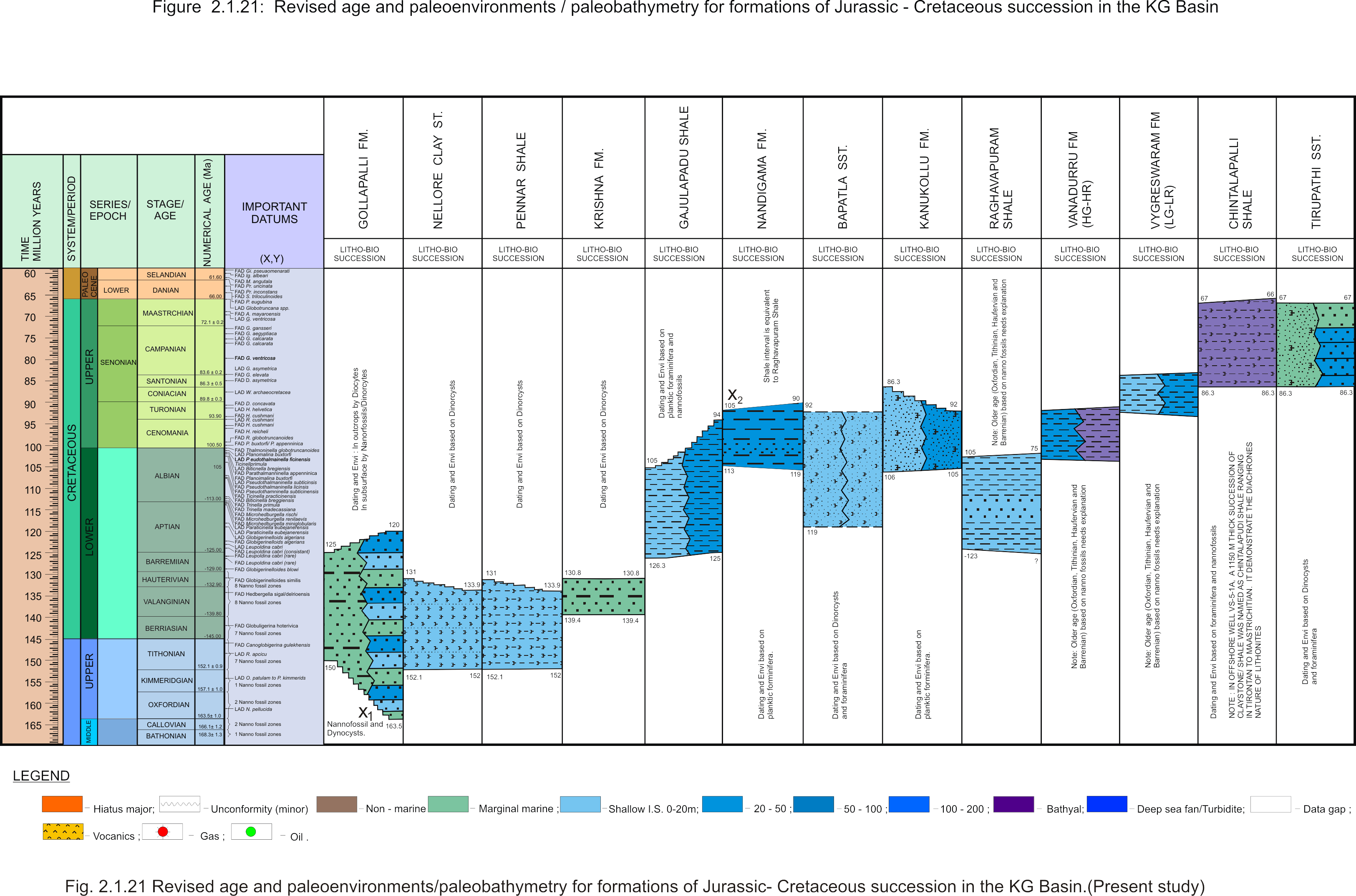
Fluvial-Marginal marine.
[Figure: Revised age and paleoenvironments/paleobathymetry of formations of Jurassic-Cretaceous succession in KG Basin in Raju et al., 2021, ONGC Bulletin, Special Issue, Vol. 56, No. 2]
Additional Information


